Description
This project was created to act as a final project submission for the EAPS591 course Cybertraining for FAIR Data Science offered by Purdue University for the Fall 2019-2020 semester. The aim of this project is to create a workflow for analysis and modeling experiments to produce Findable, Accessible, Interoperable and Reusable (FAIR) science in hydrological, weather and climate studies.
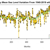
This project will evaluate the performance of several models so an informed decision can be made on which type of model should be used to further study the mean sea level data. Data has been obtained from the NOAA website and it has been processed to create models using several statistical techniques such as linear, loess and the kNN method of Statistical Machine Learning.
Cite this work
Researchers should cite this work as follows:
- Manaktala, A. (2019). Modeling the Sea Level Changes in Guam. Purdue University Research Repository. doi:10.4231/0A0F-7A84
Tags
Notes
First version of the project. Analysis is limited to the area of Guam and the files contain the preliminary code to evaluate the different statistical models and understand its applicability on mean sea level data.
