Description
Climate data for sixteen different climate stations in the Western Lake Erie Basin (WLEB) was generated as a part of complete dissertation by Sushant Mehan, Ph.D. Candidate in the Purdue University Department of Agricultural and Biological Engineering, under the guidance of Dr. Margaret W. Gitau. All related datasets for this dissertation may be accessed here: http://doi.org/10.4231/R70000B4.
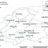
The reliable climate future projections were developed for precipitation and temperature (maximum and minimum) from nine different climate models for sixteen ground based climate stations using historic climate data from 1966-2005 obtained from National Climate Data Center (NCDC). The projections are corrected for their bias from 2006-2099. The ground-based climate stations used for analysis are Adrian, MI; Berne WWTP, IN; Bowling Green WWTP, OH; Bucyrus, OH; Decatur, IN, Defiance, OH; Findlay Airport, OH; Findlay WPCC, OH; Fort Wayne, IN; Lima WWTP, IN; Montpellier, OH; Norwalk, OH; Pandora, OH; Sandusky, OH; Vanwert, OH; and Wauseon, OH.
Each station has temporal data for ground based climate station from 1966-2015 and future climate values for two different emission scenarios (medium- RCP 4.5 and high- RCP 8.5) for 2006-2099. The future climate timelines are decided based on rigorous time series analysis based on change detection analysis and regression models.
RCP4.5 is climate projection scenario or Representative Concentration Pathway (RCP) climate scenario with radiative forcing (balance of incoming and outgoing energy in earth-atmosphere system, measured in W/m2) 4.5 W/m2 post 2100, which is equivalent to 650 ppm (parts per million) CO2 in the atmospheric system with an expected global temperature anomaly of 2.4°C increase (Wayne, 2013).
RCP8.5 is climate projection scenario or Representative Concentration Pathways (RCP) climate scenario with radiative forcing (balance of incoming and outgoing energy in earth-atmosphere system, measured in W/m2) 8.5 W/m2 in 2100, which is equivalent to 1370 ppm (parts per million) CO2 in the atmospheric system with an expected global temperature anomaly of 4.9 °C increase (Wayne, 2013).
Cite this work
Researchers should cite this work as follows:
- Mehan, S.; Gitau, M. W. (2019). Spatial-Temporal Climate Projection Data for 21st-century for the Western Lake Erie Basin (WLEB) for hydrologic studies. Purdue University Research Repository. doi:10.4231/R73R0R42
Tags
Notes
This dataset was prepared after testing specific bias correction techniques, including power transformation of precipitation, variance scaling of temperature, and stochastic weather generators, including CLIGEN and LARS-WG. This is the best corrected data achieved using the different methods tested in Mehan et al., (2018). The users can evaluate other methods of bias correction. Everyone is allowed to copy, modify, distribute, and perform the work using the dataset. The authors make no warranties and are not liable for any errors arising out of or in connection to access or use of the dataset and associated materials.
Mehan, S., Gitau, M. W., and Flanagan, D. C.: Development of reliable future climatic projections to assess hydro-meteorological implications in the Western Lake Erie Basin, Hydrol. Earth Syst. Sci. Discuss., https://doi.org/10.5194/hess-2018-204, in review, 2018.
